
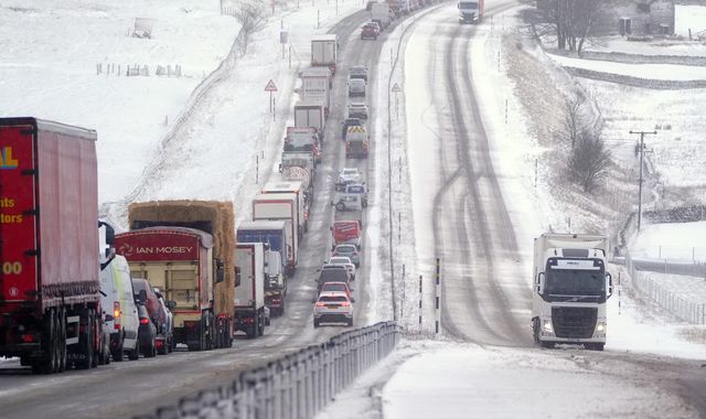
A yellow alert for snow is in force for parts of the UK, with forecasters warning of possible travel disruption.
The warning is in place until 11am and stretches from the West Midlands to southwest Scotland, the Met Office has said.
The affected area covers much of Yorkshire, as well as Derbyshire, Northumberland, Greater Manchester, Cumbria and Lancashire.
Some roads and railways are likely to be impacted, and there is a "small chance" of power outages and an impact on mobile phone service, according to forecasters.
Elevated areas at 100m or higher will see the greatest impact, with any snow falling below that altitude likely to be temporary and melt quickly, the Met Office said.
Snow depths of 1cm to 5cm are likely in some areas, while locations above 300m could potentially see 5cm to 15cm, it added.
Met Office meteorologist Alex Burkill said that potential snow will be accompanied by "some blustery, strong, gusty winds", as well as possible rain, thunder and hail.
More from Sky News:
Why a million young people are out of work
Brand's prison statement 'an insult to victims'
It comes after the UK saw its coldest night of the season so far over the weekend, with a low of -7.7C (18F) recorded at Tulloch Bridge in the Scottish Highlands.
The UK Health Security Agency (UKHSA) has issued a yellow cold health alert for the North West, North East and Yorkshire and the Humber, which is in place until 9am on Thursday.
The alerts mean weather conditions could result in an increased use of healthcare services and a greater risk to life for vulnerable people.

(c) Sky News 2026: UK weather: Snow warning in place for parts of country this morning
 Prison sentence for teen e-bike killer increased after appeal
 UK sanctions eight firms building Israeli settlements in the West Bank
 Americans urged to 'keep a low profile' in UK amid terror threat over festive season
 The 'crayon test' and the wrong plastic: Read this before buying your next olive oil